Construction Services
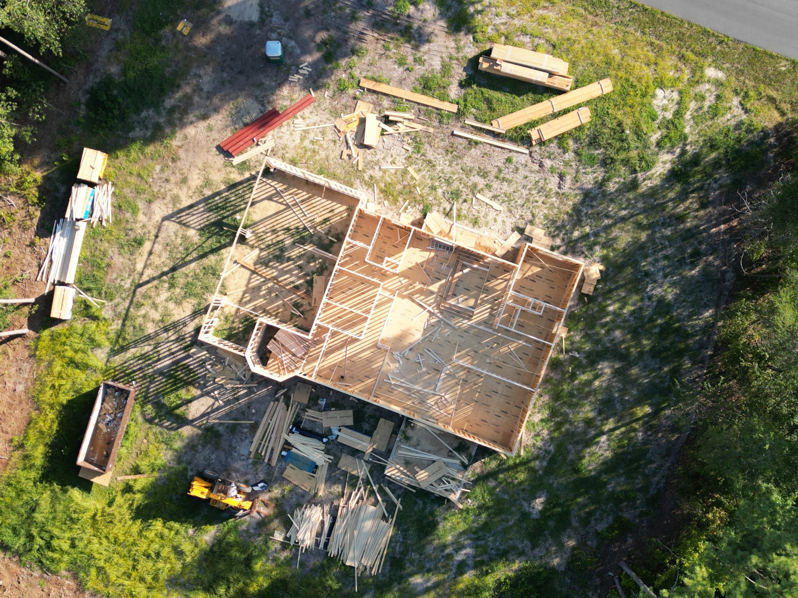
Many construction projects can benefit from the use of drones. Generally, drone data is more useful for larger projects like roads, railways, bridges, dams, and utility projects., however, even small-scale projects can benefit from the highly accurate drone construction data.
- Drone In Constructions Safety – Safety is a top priority for any reputable organization. Using drones while planning and during a construction project, potential hazardous situations can be caught early and remedied before there is a problem which very well may shut down a project if it is serious!
-
Construction Management with Drones – Drones in the construction industry are used for surveying, volumetric analysis, site planning, 3D modeling, digital elevation modeling, orthomosaics, equipment tracking, security, worker safety, inspections, project monitoring. The is perfect for pre-construction planning and an overall view of the project at all times.
-
Constructions Monitoring – Track overall project progress, track cut & fill materials (provides backups for billings), and provide highly detailed reports for the project owners.
-
3D Models or Digital Twins – Architectural 3D modeling has been around for many years, and it has become more prevalent in the construction industry with the introduction of portable LiDAR scanners. Using drones, we can accurate model of the project as stitched pictures, a point cloud model utilizing LiDAR, or both.
-
Orthomosaic Site Mapping for Construction – An orthomosaic map is created by flying over and taking 100’s of photos and then stitching them together. This provides a current map that you can utilize similar to Google Maps, but the quality is much better!
-
Drone Surveying – Partnering with a surveyor of your choice, or a local team, we can provide a survey accurate map utilizing ground control points set by the surveyor. This will provide a map with centimeter level accuracy, in the XYZ plane, that you can trust to use for accurate measurements.
-
Drone/AutoCAD Overlays – Change orders are often an area of discontent for project owners, and there are construction companies out there that take advantage of change orders to increase their profits due to errors on their part. Using commercial drone imaging to capture as-built conditions, to overlay CAD design data analysis is an exceptional value added resource during the construction process. Doing so allows construction managers to compare as-built conditions with design documents to ensure the current conditions align with the design. This simple exercise can prevent $1000’s or even $100,000 of dollars in costly rework.
- Construction Site Aerial Photography – They say a picture is worth 1.000 words. This is especially true when people are doing research on your company and want to see some of y our past projects. Your team has worked hard and created an excellent product, showcase what your team can do and why they are the best in the business.
DroneX Industries is happy to partner with you whether you are a general contractor or a project owner. Our team is experienced as an owner and contractor representative, and our construction background makes us well suited to evaluate your project and bring any issues we may see to your attention immediately to save everyone some time, stress, and money!
